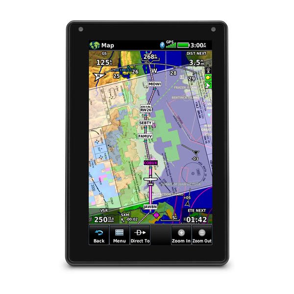
Screen
7"
The flagship of the aera line — a portable Garmin aviation receiver with a bright 7-inch touchscreen, the largest in the family. Built-in Wi-Fi and Bluetooth give wireless database updates and Connext connectivity; hard-wired, it doubles as a panel navigator with autopilot coupling.

AeroTab updates the receiver’s aeronautical databases on the AIRAC cycle, including coverage for Russia and neighbouring states.
Airports, runways, radio navigation aids, waypoints, airways, frequencies and instrument procedures in ARINC-424 format.
◷ AIRAC cycle · 28 daysMasts, towers, stacks, power lines and other man-made obstacles with heights — for terrain and obstacle proximity alerts.
◷ 56 daysA digital elevation model of the terrain for displaying high ground and terrain alerts (TAWS/HTAWS).
◷ As revisedAirport movement diagrams: runways, taxiways and aprons geo-referenced to the map — for ground orientation.
◷ 56 daysOfficial approach, departure and airport charts displayed directly on the receiver.
◷ AIRAC cycle · 28 daysTerrain underlay: coastlines, rivers, roads and settlements — the backdrop beneath the aeronautical picture.
◷ RarelyGeneral and business aviation pilots who want a large, readable screen in the cockpit.
Those flying in Russia and neighbouring states who want current databases where Garmin has no official coverage.
Owners who use it both as a portable and as a hard-wired navigator with autopilot coupling.
Leave your contact — we will get in touch to confirm the configuration, database coverage and delivery terms.